Annapurna Circuit Trek
£909 was £1299
Discount: 30%
Offer end: Aug 31 2025
Duration: 18 days
Begins: Kathmandu
Ends: Kathmandu
Trip Code: ANTA
From
£909 per person
Overview
- Your Welcome Moment: Welcome Moment - Meet Your CEO and Group
- Your Local Living Moment: Narchyang Community Homestay, Narchyang
- English-speaking local guide and full support team of porters and assistants for the Annapurna Circuit trek
- Walk along the Marshyangdi River
- Visit Bung chahara Water fall
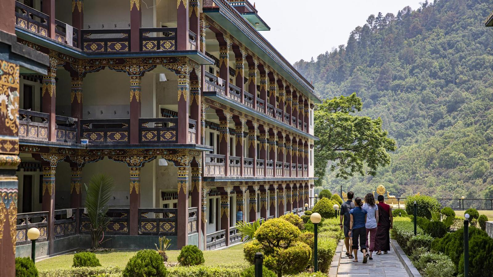
- Experience the unique architecture of Bagarchhap region
- Explore Manang village and hike to the stupa
- Relax in hot springs of Narchyang
- All transport between destinations and to/from included activities
Hotels/guesthouses (3 nts), homestay (1 nt), tea house lodges (13 nts).
1 breakfast, 1 lunch, 1 dinner
Allow USD410-535 for meals not included.
Bus, walking, 4WD Jeep.
CEO (Chief Experience Officer) throughout, trekking support staff.
Full Itinerary
Departure Dates
Day 1 : Kathmandu
Arrive in Kathmandu at any time. Attend the group welcome meeting today and enjoy a brief orientation walk around Thamel.
Welcome Moment - Meet Your CEO and Group
Your opportunity to meet your CEO and fellow travellers, and learn more about your tour. Opt to join the group for a local meal afterwards. Don't forget to see the notice in the lobby (or ask reception) for the official time and place to meet up with the group.
Kathmandu Orientation Walk
Get a taste of this lively capital city, which is fascinating at every turn.
Acommodation
Kantipur village
Acommodation
Kantipur village
Day 2 : Kathmandu/Jagat
Travel through scenic landscapes, picturesque countryside, and small towns along the way to Besi Sahar. The group will arrive in time for lunch. After lunch, the group will take the local transportation to Jagat along a winding, narrow road. Spend the night at the teahouse.
Private Vehicle
Settle in and scan the scenery from the convenience of a private vehicle.
Local Bus
Climb aboard, grab a seat, and enjoy the ride.
Acommodation
Eco Lodge
Acommodation
Eco Lodge
Day 3 : Jagat/Bagarchhāp
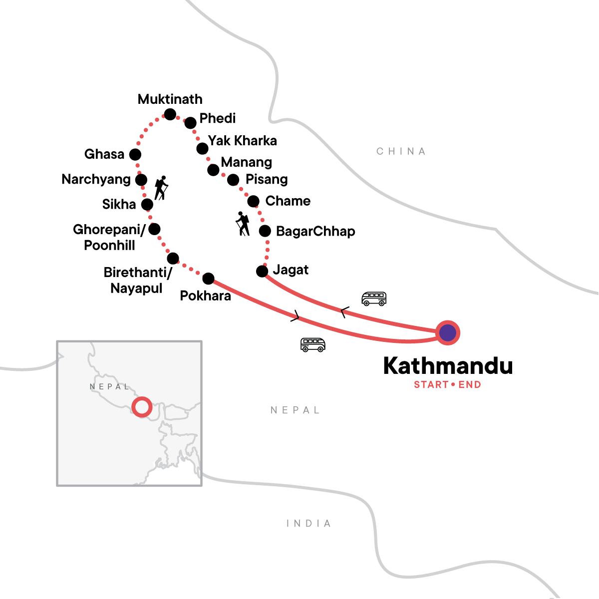
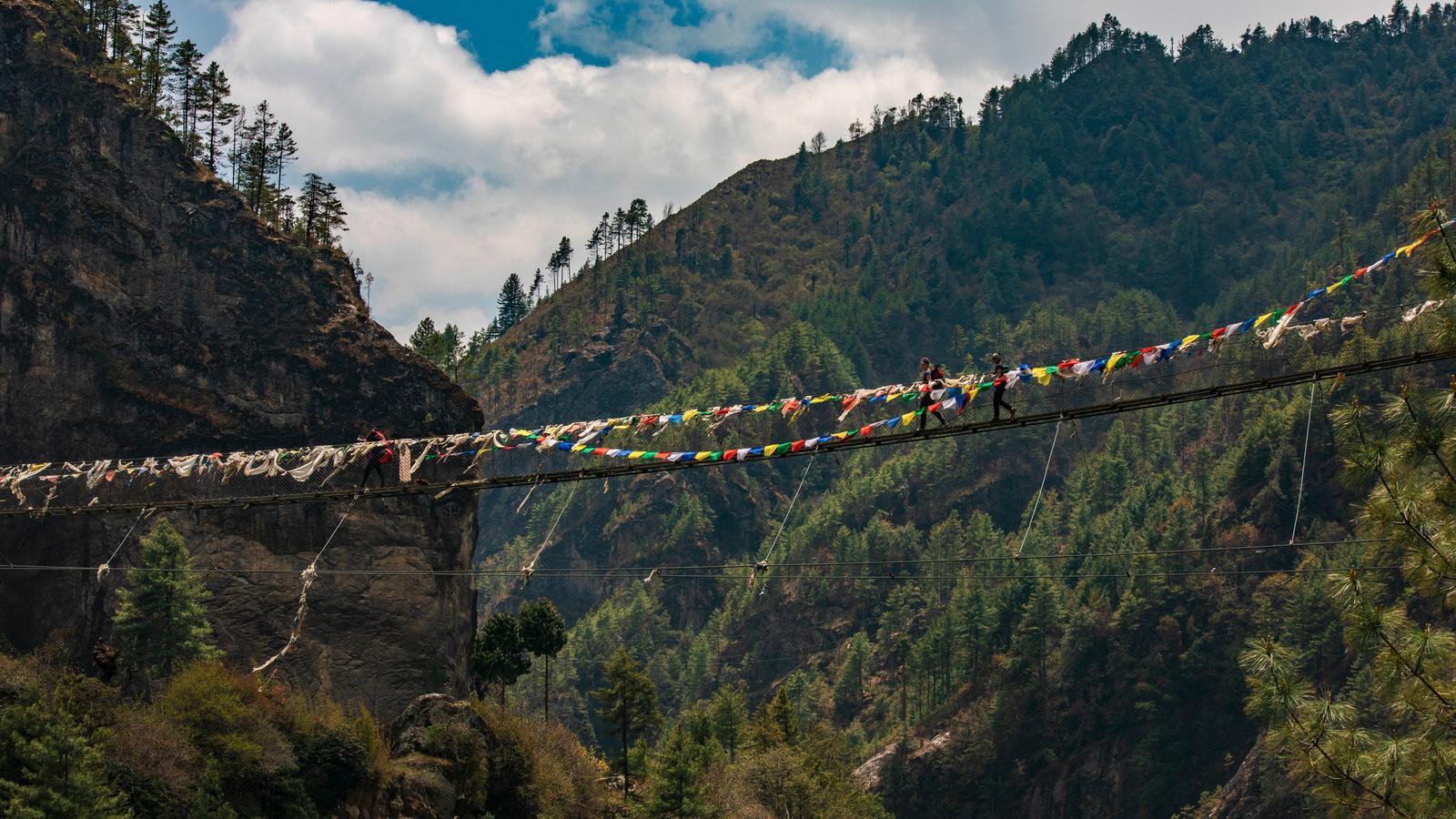
Begin 13 days of challenging trekking in one of the highest mountain ranges on Earth. Experience stunning Alpine pastures, forests of rhododendron, temples, rural villages and local people, waterfalls, glaciers, and some of the most spectacular mountain scenery known to man. Today, the group will travel 14km on foot from Jagat to Bagarchhap. Ascend through forested areas of rhododendron (seasonal) and pine trees. Pass by waterfalls, traditional villages, and terraced fields of crops.
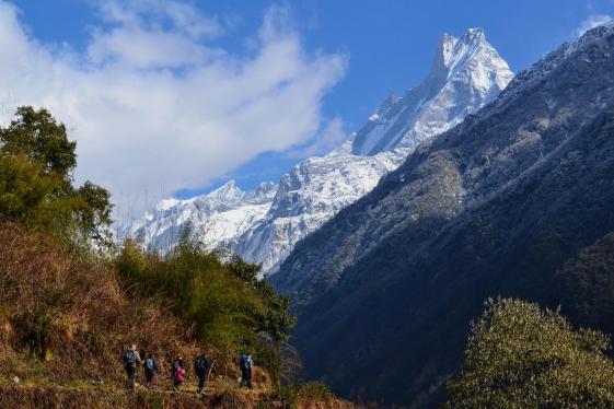
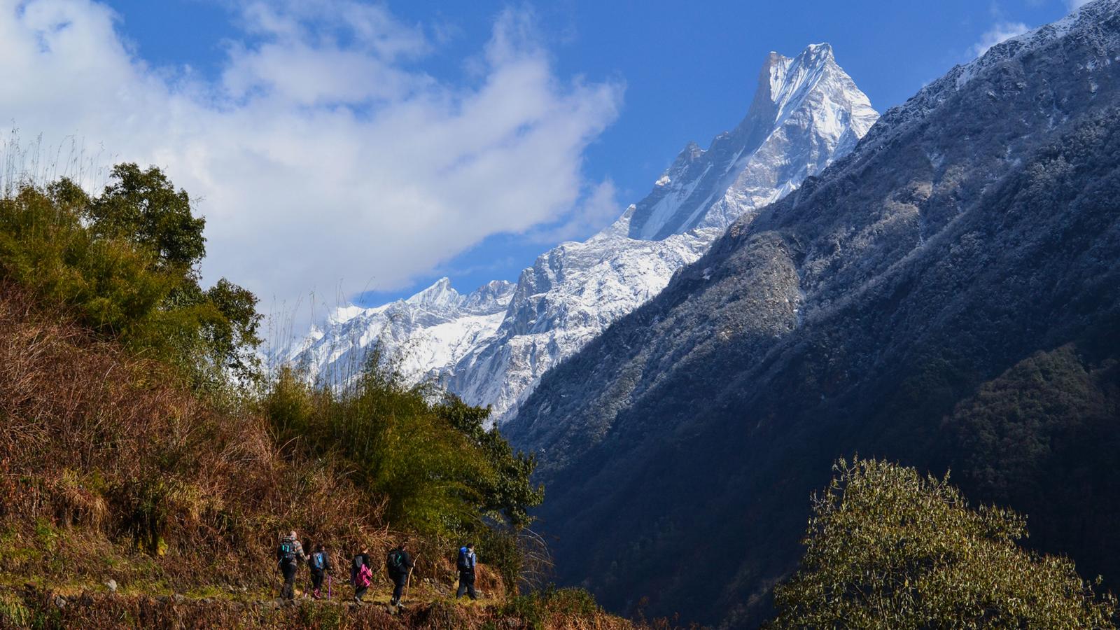
For almost 2 weeks, we immerse ourselves into the spectacular mountain wilderness of the Annapurna Range. At 8,091m (26,545ft) Annapurna 1 is one of the highest mountains in the world. Its surrounding sister mountains are equally imposing, creating magnificent panoramas from any view point. Throughout the trek we come across isolated mountain communities, each observing different ancestral customs and traditions, resulting in not only a visually superb expedition but also a culturally rich one. Amid the rugged mountain scenery, we meet warm and welcoming locals herding yaks and goats on grassy pastures, and visit their monasteries and temples. Along the way, we see waterfalls of melted snow, cross icy rivers, broad plains, and high mountain passes and reward ourselves with a soak in natural hot springs (you've earned this!). The trekking is challenging, averaging 6-7 hrs a day, often at high altitudes. The highest point we reach, occurring on Day 9, is the 5,416m (17,769ft) Thorung Pass.
Given the dangers of altitude sickness, it is imperative that we take at least 3 days to ascend to this height. A couple of days are also allowed for rest and acclimatisation.
Details for the trek are as follows. Please note however that the exact itinerary can vary due to unforeseen circumstances including weather conditions or bandhs (strikes) called by the government.
Annapurna Circuit Trek Jagat to Bagarchhap
Cross breathtaking landscapes and winding paths around the mountains. Steep sided valleys filled with lush vegetation line the way to Bagarchhap. Leave Jagat behind and ascend through a forested area to reach the village of Chamje (1410m). From Chamje walk along the Marshyangdi River and pass through beautiful forests of rhododendron (seasonal) and pine trees. Have lunch at Tal Village. As the group approaches Bagarchhap (2160m), the trail becomes steeper and you'll begin to see the houses of the Manang Region – built from stone and slate roofs. Walking distance - 14 Kms. Time 6-7 hours. Elevation gain - 860m Terrain: mostly rocky terrain with mixed forested areas.
Acommodation
Royal Mountain Lodge
Acommodation
Royal Mountain Lodge
Day 4 : Bagarchhāp/Chame
Today, trek from Bagarchhap to Chame (2,670m, 8,760ft). Breathe in the fresh mountain air and climb up along the trail through dense pine and fir forests. Enjoy stunning views along the way of Manaslu and other peaks of the Annapurna range. Have lunch in Thanchok before continuing on to Chame, the district headquarters of Manang.
Annapurna Circuit Trek From Bagarchhap to Chame
Trek from Bagarchhap to Chame and watch as the scenery changes to more Alpine surroundings. Breathe in the fresh mountain air. Climb up along the trail through dense pine and fir forests to reach the village of Timang (2630m), and enjoy stunning views along the way of Manaslu and other peaks of the Annapurna range. After reaching the village, the trail continues to climb up through the forest to reach Thanchok where the group will have lunch. From there, pass through the Marshyangdi River, apple orchards, and more small villages before reaching Chame. Chame is the district headquarters of Manang with a few shops and guest houses, which are mostly traditional Manang styled houses. Walking distance – 20 kms. Time 6-7 hours. Elevation gain - (550m) Terrain: Rocky, crossing through pine forests with a mix of steep and gradual ascents
Acommodation
Marshyangdi Mandala
Acommodation
Marshyangdi Mandala
Day 5 : Chame/Pisang
Trek from Chame to Pisang (3,300m,10,827ft). Leave the village of Chame behind, walk out past the prayer wheels and cross wide rivers and pine forests on the way to Pisang. As you hike, enjoy stunning scenery, narrow canyons, and valleys with Annapurna Range as the backdrop. Have lunch in the small, beautiful village of Dhukur Pokhari. Arrive in Pisang and visit the village monastery.
Annapurna Circuit Trek Chame to Pisang
Leave the village of Chame behind, walk out past the prayer wheels and cross wide rivers and pine forests on the way to Pisang. Today, the trail is moderately challenging with several uphill and downhill stretches, but the group will be rewarded with the stunning scenery of waterfalls, narrow canyons, and valleys with Annapurna Range as the backdrop. Today our lunch spot will be the small, beautiful village of Dhukur Pokhari. Upon reaching Pisang, take a short hike to Upper Pisang village and visit the monastery of the village. Trekking distance 15km. Trek Time 7-8 hours. Elevation gain - 620m. Terrain: Mix of rocky trails, forested areas, and open fields.
Acommodation
New Tibet Lodge
Acommodation
New Tibet Lodge
Day 6 : Pisang/Manang
Trek from Pisang to Manang (3,540m, 11,614ft). Today, enjoy stunning views of Annapurna Range, pass through the village of Braga, with its ancient monastery from the 8th Century. Then, continue towards Manang village, passing through fields of barley and buckwheat.
Annapurna Circuit Trek from Pisang to Manang
Cross the Marsyandi River on the way out to Manang. Leave Pisang behind, head out west, passing several small villages and fascinating Buddhist monasteries before arriving at Manang, the largest village in the area. Stop in Manang overnight. Trekking Distance 16km. Trek time 6-7 hours. Elevation gain - 240m. Terrain: Initial part is flat along the banks of Marshyangdi river, later it is dusty and rocky terrain as the trail climbs up through dense pine and juniper forest.
Acommodation
Mountain Lake Lodge
Acommodation
Mountain Lake Lodge
Day 7 : Manang
Enjoy an acclimatization day in Manang. Set off on a short excursion hike to Gangapurna Lake, sitting at 3700m. Have lunch in Manang and explore the village before hiking to a Stupa located in the hills outside of Manang.
Acclimatization Day
The dramatic setting of Manang makes for a pleasant rest and acclimatization day with the added benefit of hot showers. The best way to acclimatize is to do some high climbing then return to the lower altitude of Manang for sleeping.
Acommodation
Mountain Lake Lodge
Acommodation
Mountain Lake Lodge
Day 8 : Manang/Yakkharka
Trek from Manang to Yak Kharta (4,018m, 13,182ft). Today, is a relatively short walking day with only 9kms in distance covered. Trek slowly and climb higher as the trail passes through a sparse forest of juniper and scrub. After lunch in Yak Kharka, complete an acclimatization hike in the surrounding area.
Annapurna Circuit Trek from Manang to Yak Kharka
Trek through Manang, where the altitude continues to rise as the route snakes through the mountains and up to Yak kharka. Today, is a relatively short walking day with only 9kms in distance covered. Trek slowly and climb higher, feeling the temperature drop significantly as there is a decrease in oxygen levels. The trail passes through a sparse forest of juniper and scrub. Yak Kharka is a very small settlement with a handful of teahouses. After lunch in Yak Kharka, complete an acclimatization hike in the surrounding area for another hour or two. Trekking distance 9km. Trek time 5-6 hours. Elevation gain - 510m Terrain: Mostly uphill, rocky trails, and steep ascents, landscape becomes barren, possibility of snow.
Acommodation
Ganga Purna
Acommodation
Ganga Purna
Day 9 : Yakkharka/Phedi
Trek from Yak Kharka to Phedi (4,450m, 14,600ft). Enjoy a short, but challenging hike today from Yak Kharka to Phedi. Begin with a gradual ascent through the alpine landscape and pass through pastures of grazing yak, small chortens, and streams en route.
Annapurna Circuit Trek from Yakkharka to Phedi
Trek from Yak kharka via pastures of grazing yak, small chortens, and streams before arriving at Phedi. The hiking time will be shortened today as the group continues to trek into higher altitudes. Begin with a gradual ascent through the alpine landscape. The final stretch of the trek is quite challenging. Trekking distance 7-8km. Trek time 3-4 hours. Elevation gain - 370m
Acommodation
Ganga Purna
Acommodation
Ganga Purna
Day 10 : Phedi/Muktināth
Trek from Phedi to Muktinath (3,800m, 12,467ft). Today the group will reach the highest point of the trek. This is the toughest uphill walking day. Keep a slow steady pace and enjoy the views while hiking. After reaching the top of Thorong La Pass (5416m) the group will follow the trail as it descends steeply for several kilometers to Muktinath – an important pilgrimage site for both Hindu’s and Buddhists.
Annapurna Circuit Trek from Phedi to Muktināth
Today is the “THE DAY” of our Annapurna Circuit Trek. Begin around 3AM or 4AM with a steep climb up to Thorong La Pass (5416m) – the highest point of the trekking route. We begin the day early in order to avoid the strong wind at Thorong La and to enjoy the majestic and panoramic views of the mighty Annapurna Ranges at the top. Hiking this early requires a headlamp or torch to light the way. After reaching the top, the trail descends steeply for several kilometers to Muktinath – an important pilgrimage site for both Hindu’s and Buddhists. Trek Distance 20km. Trekking time 7-8 hours. Elevation gain - 996m Terrain: Mostly rocky with steep drops on one side, and rugged cliffs on the other, narrow path and possibility of snow.
Acommodation
Bob Marley Guest House
Acommodation
Bob Marley Guest House
Day 11 : Muktināth/Ghasa
Take a 4WD jeep ride from Muktinath to Ghasa today and take a break from trekking. On the drive, view the contrasting yellow hills against green farmland of the valley floor. See the Kaligandaki, the deepest gorge in the world. Witness the dramatic changes in landscape of the Kaligandaki River and journey past several picturesque villages.
4WD Jeep Drive from Muktinath to Ghasa
Drive from Muktinath to Ghasa in a 4WD jeep. The drive time is about 4-5 hours and a total of 57km. Some parts of the road are black topped while some are still bump, mountainous roads.The route passes through the Kaligandaki Gorge, which is the one of the deepest gorges in the world. Along the way, witness the dramatic changes in landscape of the Kaligandaki River and several picturesque villages. Terrain: Varied Terrain, some sandy and some rocky trails, leading to Kaligandaki river, later, steep with steps and a rocky path.
Acommodation
See You Lodge
Acommodation
See You Lodge
Day 12 : Ghasa/Narchyang
Trek from Ghasa to Narchyang today. Travel on foot through the Kali Gandaki Valley and the lower Mustang region of Nepal. Walk along the Kali Gandaki River and through lush forests of rhododendron, oak, and bamboo. Upon arriving at Narchyang, our host community members will welcome the group. Narchyang once used to be the gate for North Annapurna Base Camp Trekking route. But with the Annapurna Base Camp being shifted to south, the village has remained isolated and devoid of tourism for a long time. In order to boost the amount of visitors to the region, the community has recently been active through Narchyang Community Homestay and started welcoming trekkers to their homes. The community is mostly of Magar Culture and are known for their innocence, simplistic ways of life, and bravery.
Annapurna Circuit Trek from Ghasa to Narchyang
The trek from Ghasa to Narchyang takes the group through the Kali Gandaki Valley and the lower Mustang region of Nepal. Cross the Kali Gandaki River and walk through the lush forest of rhododendron, oak, and bamboo. Upon arriving at Narchyang, our host community members will welcome the group to their village and community. Later in the afternoon walk for around 30 minutes and enjoy a dip in a natural hot spring to sooth those aching muscles from the trek. Trekking distance 14km. Trekking duration 4-5 hours. Elevation change - 800m Terrain: Some steep descents, some gentle climbs, varied vegetation, sub tropical forest and stone steps.
Narchyang Community Homestay
Set in the lower village, the Narchyang homestay offers a glimpse into traditional village life. Learn about the Magar culture and the Magar Kura language from your hosts and embrace this unique opportunity to live like a local. Get to know your hosts more over dinner as you enjoy a homemade meal of Nepali Dhido Set - typical cuisine for the area. Set in the lower village, the homestay provides the perfect starting point for exploring. Hike to the upper village for spectacular mountain views.
Acommodation
Narchyang Community Homestay
Acommodation
Narchyang Community Homestay
Lunch | Dinner
Day 13 : Narchyang/Sikha
Today the group will ascend once again on the trek. Walk through the forests and terraced fields, and climb uphill admiring the stunning views of Annapurna South and Hiunchuli along the route. Reach a mesmerizing view of ascending levels of teahouses and lodges with the mountains surrounding. Today's hike will be 4-5 hours.
Annapurna Circuit Trek from Narchyang to Sikha
Walking through the beautiful rhododendron (seasonal) forests and terraced fields and trek uphill admiring the stunning views of Annapurna South and Hiunchuli. Trekking Distance 11 Kms. Trekking Duration. 4-5 hours. Elevation gain 730m. Terrain: Mix of rocky trails, dense forest, occasional streams and terraced farmlands.
Acommodation
See You Lodge
Acommodation
See You Lodge
Breakfast
Day 14 : Sikha/Ghorepani
Today trek from Sikha to Ghorepani (2,785m, 9,137ft). The route is seeped in history and the views of Machhupuchare and the Himalayas from Ghorepani are absolutely unmatched on a clear day. View local villages, teahouses, and settlements along the uphill route.
Annapurna Circuit Trek from Sikha to Ghorepani
From Sikha, take a route seeped in history all the way to Ghorepani; myths and stories of the origins of the indigenous people of the Annapurna region abound. The views of Machhupuchare and the Himalayas from Ghorepani are absolutely spectacular on a clear day. The trek while relatively short, is a very steep climb through the forest offering beautiful views of the mountains and valley below. Trekking Distance 8km. Trekking Duration 4-5 hours. Elevation gain - 920m. Terrain: Terraced fields, uphill ascents through the rhododendron and oak forests.
Acommodation
See You Lodge
Acommodation
See You Lodge
Day 15 : Ghorepani/Birethanti
Enjoy an early morning excursion to Poon Hill for sunrise. Then venture through Poonhill to Ramghai, enjoying spectacular views of the Annapurna range along the way. Cross through forests, streams, and bridges to reach the final destination, Birethanti.
Poon Hill Excursion
Take in the incredible mountain scenery that lines the route from Ghorepani to Poon Hill (3210m). Enjoy the views across rhododendron forests and of spectacularly coloured birds during the trek. Arrive at Poon Hill to enjoy some of Nepal's best vistas. Walking distance : 2kms Time: 1.5 - 2 hours Elevation gain: 363m Terrain: mostly rocky terrain with mixed forested areas.
Annapurna Circuit Trek Day from Ghorepani to Birethanti
Trek from Poon Hill to Birethanti. The views from Poon Hill are absolutely stunning and are known to be among the best in the area. The trail starts with a steep uphill climb through the rhododendron forest. After breakfast at the top, the group will begin the down hill walk all the way to Ramghai (Birethanti). This is the last day of the trek. Enjoy a final day in the mountains with the team of our guides and porters, thanking them for their effort in endlessly supporting our trek and making it successful. Trekking Distance 14km. Trekking Duration 8-9 hours. Elevation gain - 360m. Elevation decrease - 2,185m. Terrain: Mostly downhill, through rhododendron forests and farmlands.
Trek from Poon Hill to Nayapul. The views from Poon Hill are among the best in the area. Enjoy the views across the Annapurna region.
Acommodation
Ever Green Lodge
Acommodation
Ever Green Lodge
Day 16 : Birethanti/Pokhara
Take a short hike from Birethanti to Nayapul where our bus will be waiting to take us to Pokhara. Rest and take a well-deserved shower in this lakeside resort town.
Hike from Birethanti to Nayapul
Complete the final leg of your trek with a 30 minute hike to Nayapul where the bus awaits.
Private Vehicle
Settle in and scan the scenery from the convenience of a private vehicle.
Acommodation
Hotel Queens Park
Acommodation
Hotel Queens Park
Day 17 : Pokhara/Kathmandu
Return to Kathmandu.
We travel back to Kathmandu where the rest of the day is free for shopping, sightseeing, or relaxing in one of the many rooftop cafés.
Private Vehicle
Settle in and scan the scenery from the convenience of a private vehicle.
Free time:
Enjoy some free time in Khatmandu by shopping, sightseeing, or simply enjoying a cup of warm chai in a roadside café.
Acommodation
Kantipur village
Acommodation
Kantipur village
Day 18 : Kathmandu
Depart at any time.
Departure Day
Not ready to leave? Your CEO can help with travel arrangements to extend your adventure.
Optional Activities - Day 18
Everest Flight
Get a close look at awesome Mt. Everest, the highest mountain in the world, without having to do any climbing; this one-hour plane tour will give you an unforgettable experience.
| dates start-End | Availability remaining spaces | Price Per Person | |
|---|---|---|---|
| Aug 2025 | |||
| Sun, 24 Aug - Wed, 10 Sep | 5 available | £1,299 | Request a quote |
| Sep 2025 | |||
| Sun, 07 Sep - Wed, 24 Sep | 7+ available | £909 | Request a quote |
| Sun, 21 Sep - Wed, 08 Oct | 7+ available | £1,007 | Request a quote |
| Sun, 28 Sep - Wed, 15 Oct | 5 available | £1,439 | Request a quote |
| Oct 2025 | |||
| Fri, 03 Oct - Mon, 20 Oct | 3 available | £1,439 | Request a quote |
| Sun, 05 Oct - Wed, 22 Oct | 1 available | £1,439 | Request a quote |
| Sun, 12 Oct - Wed, 29 Oct | 7+ available | £1,007 | Request a quote |
| Fri, 17 Oct - Mon, 03 Nov | 7+ available | £1,439 | Request a quote |
| Sun, 19 Oct - Wed, 05 Nov | 7+ available | £1,439 | Request a quote |
| Sun, 26 Oct - Wed, 12 Nov | 7+ available | £1,439 | Request a quote |
| Nov 2025 | |||
| Sun, 02 Nov - Wed, 19 Nov | 1 available | £1,369 | Request a quote |
| Sun, 09 Nov - Wed, 26 Nov | 7+ available | £1,369 | Request a quote |
| Sun, 16 Nov - Wed, 03 Dec | 7 available | £1,369 | Request a quote |
| Sun, 23 Nov - Wed, 10 Dec | 7+ available | £1,369 | Request a quote |
| Sun, 30 Nov - Wed, 17 Dec | 7+ available | £1,369 | Request a quote |
| Dec 2025 | |||
| Sun, 14 Dec - Wed, 31 Dec | 7+ available | £1,369 | Request a quote |
| Mar 2026 | |||
| Sun, 01 Mar - Wed, 18 Mar | 7+ available | £1,369 | Request a quote |
| Sun, 15 Mar - Wed, 01 Apr | 7+ available | £1,369 | Request a quote |
| Sun, 22 Mar - Wed, 08 Apr | 7+ available | £1,439 | Request a quote |
| Sun, 29 Mar - Wed, 15 Apr | 7+ available | £1,439 | Request a quote |
| Apr 2026 | |||
| Sun, 12 Apr - Wed, 29 Apr | 7+ available | £1,439 | Request a quote |
| May 2026 | |||
| Sun, 03 May - Wed, 20 May | 7+ available | £1,369 | Request a quote |
| Jun 2026 | |||
| Sun, 07 Jun - Wed, 24 Jun | 7+ available | £1,299 | Request a quote |
| Jul 2026 | |||
| Sun, 12 Jul - Wed, 29 Jul | 7+ available | £1,299 | Request a quote |
| Sep 2026 | |||
| Sun, 13 Sep - Wed, 30 Sep | 7+ available | £1,299 | Request a quote |
| Sun, 20 Sep - Wed, 07 Oct | 7+ available | £1,439 | Request a quote |
| Sun, 27 Sep - Wed, 14 Oct | 7+ available | £1,439 | Request a quote |
| Oct 2026 | |||
| Fri, 09 Oct - Mon, 26 Oct | 7+ available | £1,439 | Request a quote |
| Sun, 18 Oct - Wed, 04 Nov | 7+ available | £1,439 | Request a quote |
| Fri, 30 Oct - Mon, 16 Nov | 7+ available | £1,439 | Request a quote |
| Nov 2026 | |||
| Sun, 08 Nov - Wed, 25 Nov | 7+ available | £1,369 | Request a quote |
| Fri, 13 Nov - Mon, 30 Nov | 7+ available | £1,369 | Request a quote |
| Sun, 29 Nov - Wed, 16 Dec | 7+ available | £1,369 | Request a quote |
| Dec 2026 | |||
| Sun, 27 Dec - Wed, 13 Jan | 7+ available | £1,369 | Request a quote |

